5 best navigators for the forest
Do you like to carry out multi-day forays into nature? Or are you an avid hunter? Anyway, you may have noticed that the smartphone does not provide the necessary information in the forest. First, away from the settlement, you have to rely on offline maps that have a low level of detail. Secondly, finding smart topographic maps for a smartphone is extremely difficult. Ordinary maps often do not display small streams, ponds and even lakes. Not to mention the fact that they do not indicate which trees grow in the more often you are going to. In short, for good reason there are so-called tourist GPS-navigators. They are set exactly topographic maps, very useful during hunting, fishing and hiking. It is about these devices will be discussed in this article.
Ranking of the best navigators for the forest
| Nomination | a place | Name of product | price |
| Ranking of the best navigators for the forest | 1 | Garmin Montana 680 | 37 990 ₽ |
| 2 | Garmin GPSMAP 64st | 22 790 ₽ | |
| 3 | Garmin Fenix 3 Sapphire HR | 55 152 ₽ | |
| 4 | Garmin GPSMAP 78 | 16 300 ₽ | |
| 5 | Garmin eTrex 20x | 12 900 ₽ |
Garmin Montana 680
Rating: 4.9
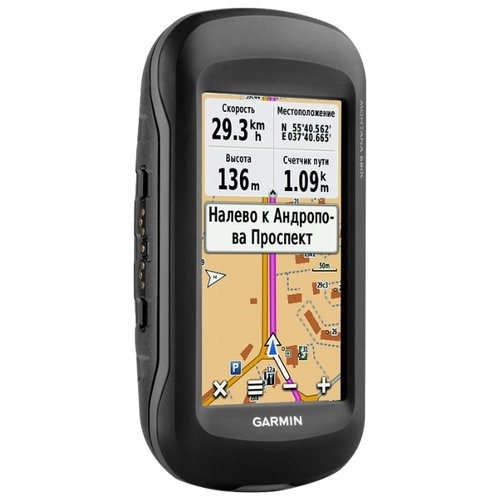
One of the most advanced GPS navigators for the forest at the time of ranking. In fact it is not a tourist, but a universal one. The fact is that it can be easily attached to the car dashboard. The 4-inch display installed here has a sensor substrate, so that you can control the navigator in a traffic jam without any difficulty. Also, this model has voice prompts, due to which you will turn right on the right street. Another method of using this GPS navigator is to attach it to the handlebars. As a result, you get a full-cycle bike computer. You can even connect heartbeat and pedal sensors, because there is support for wireless technology ANT +.
If we talk about the tourist component of the device, then the buyer is satisfied with absolutely everything. The product comes with detailed topographic maps. If there is such a desire, then no one will interfere with loading additional cards - 8 GB of permanent memory are used to store them. If this volume suddenly seems small, then the microSD card slot will come to the rescue. The maximum gadget can store up to two hundred routes. Each of them can contain up to 4,000 waypoints. If you are afraid of getting lost, the Garmin Montana 680 solves this problem - by pressing a few keys, the Track-Back mode is turned on, after which the navigator will guide you on the way back. Another must please the buyer barometer and digital compass. Both of these nice additions greatly simplify navigation.
Complete with the navigator the lithium-ion accumulator is delivered. Its full charge lasts for 16 hours of continuous operation of the navigator. You can charge the battery right in the device. If you are going on a multi-day hike, it is recommended to bring a pair of AA-batteries with you. Yes, the device can work from them!
As befits any tourist GPS-navigator, Garmin Montana 680 has a waterproof housing. But the connector for an external antenna is found in such devices much less.It should be useful if you decide to use the device in the car. However, even without an external antenna, the signal is received without any problems.
It remains to add that on the front panel of this navigator for the forest is a color display with a resolution of 272x480 pixels. Compared with the screens of smartphones, this option may seem insufficient. But in fact, it is quite enough to display detailed maps. And our rating will also confirm that many tourist navigators have a much more modest display.
Virtues
- There is a connector for an external antenna;
- Suitable for use both in the car and in the forest;
- Large amount of internal memory;
- There is a slot for microSD card;
- Built-in magnetic compass and barometer;
- A large enough screen, which is touch;
- Long battery life;
- There is support for ANT +;
- There is an 8 megapixel camera;
- There are numerous useful applications;
- The case is waterproof.
disadvantages
- Very high cost.
Garmin GPSMAP 64st
Rating: 4.8
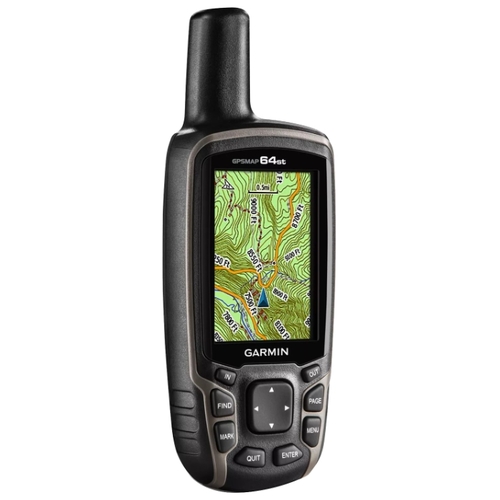
This GPS navigator for the forest is most like a walkie-talkie. The fact is that it uses an external antenna, which protrudes from the top end. Because of it, the universality declared by the manufacturer is called into question - the device is not always adequately placed on the car dashboard. However, it is also difficult to use it inside the car due to the lack of a touchscreen display - manipulations with the card and firmware are carried out only through physical buttons. We venture to suggest that this is still a navigator for a tourist, a hunter and an angler, and not for a motorist or cyclist.
The image here is displayed on a 2.6-inch display. Its resolution is only 160x240 pixels. However, this, oddly enough, is enough to distinguish all the important marks on the map. By the way, not only the map can be displayed on the screen. The product has built-in applications - for example, the calendar of hunting and fishing. Now there is no need to allocate for such programs the memory built into your smartphone!
But back to the cards. They can be completely different, including raster. They are loaded into the built-in memory, which is about 8 GB. By default, most of the space is filled with branded topographic maps. If you do not want to delete them, then it is better to download additional cards to the microSD memory card - the manufacturer has not forgotten the corresponding slot. By the way, the buyer of this tourist GPS-navigator receives as a gift an annual subscription to the BirdsEye service. This, at least temporarily, will provide it with satellite imagery of the surrounding area.
Of course, this device is able to correctly calculate the route, in the future it is not difficult to activate the Track-Back function to go back. The signal from satellites is caught steadily, while the gadget supports not only GPS, but also GLONASS. However, this applies to absolutely all modern Garmin navigators. But the connector for an external antenna is not all such devices. However, to tell you the truth, it is unlikely to ever come in handy.
Inside this model there are a barometer and a magnetic compass. All this makes navigation even easier. There is also support for ANT + technology, which actually seems superfluous. As for the battery life, it can reach 16 hours. Batteries or rechargeable batteries can be used as power sources. The latter, by the way, can be charged directly in the device. By the way, even lithium batteries are supported - you just need to remember to choose the appropriate type of power source in the settings, otherwise the device will not even turn on.
Virtues
- There are additional applications;
- There is support for ANT + and Bluetooth;
- Free subscription to BirdsEye;
- The case is waterproof;
- There is a connector for an external antenna;
- Large amount of memory;
- Not forgotten slot for microSD card;
- Long battery life;
- You can charge batteries right in the navigator;
- Included is a carbine for mounting;
- Built-in magnetic compass and barometer.
disadvantages
- The antenna may interfere in some cases;
- High price;
- Display resolution does not suit everyone.
Garmin Fenix 3 Sapphire HR
Rating: 4.7
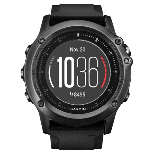
Suddenly, our rating breaks in ... smart watches! Why not? The device called Garmin Fenix 3 Sapphire HR can be used as a GPS-navigator for the forest. On the way, there will be voice prompts waiting for you; you will not turn it in the wrong direction. The device perfectly recognizes signals from both US and foreign satellites. Such smart watches will easily save the route of your run or walk. Along the way, they will record heart rate readings - the built-in heart rate monitor is responsible for this. There is also an altimeter and a digital compass, which also are not superfluous at such a moment. This athlete will not be prevented by the support of ANT + technology, thanks to which external sensors are connected to the clock.
Virtually every forest navigator has moisture protection. How else? During a hike or bike ride at any moment it may rain, the creators of such devices understood this. The Garmin Fenix 3 Sapphire HR smart watches also have such water protection - it conforms to the WR100 standard. So, you can swim in the clock - nothing will happen to them.
Here, a 1.2-inch round display is used to display information. Its resolution is 218x218 pixels. The picture is clearly visible even under the bright sun. Also, the product received a sapphire crystal - they are covered with the front panel. It seems that scratching it will not work even when walking between rocks and stones. Somewhere else on the case there is a speaker hole. Most often, this structural element will be used while following a particular route.
The product has got at its disposal only 32 MB of internal memory. There can be no talk of any pre-installed cards - they are all loaded from a nearby smartphone. This, of course, slightly limits the user, especially in hiking conditions. However, this is the only serious drawback of the device. And it fades against the background of wide functionality of smart watches. In particular, the gadget is able to offer multisports mode, as well as become a metronome for a while. You can use it to control the MP3 player located on your smartphone.
Of course, such a device could not get a very capacious battery. However, the manufacturer has worked great optimization. As a result, the full charge is enough for about 20 hours of work of the navigator in the active mode. And if you turn off the GPS, the battery life will increase even more.
Virtues
- Compact size and low weight;
- Not forgotten speaker;
- Wide functionality;
- Excellent LCD display;
- The body is made of stainless steel;
- Water protection is present;
- Built-in Wi-Fi, Bluetooth and ANT +;
- There are altimeter, heart rate monitor and compass;
- Long autonomous work.
disadvantages
- Maps are loaded from the smartphone;
- Astronomical price tag;
- NFC chip wouldn't hurt;
- In traveling conditions will have to be charged from the power bank.
Garmin GPSMAP 78
Rating: 4.7
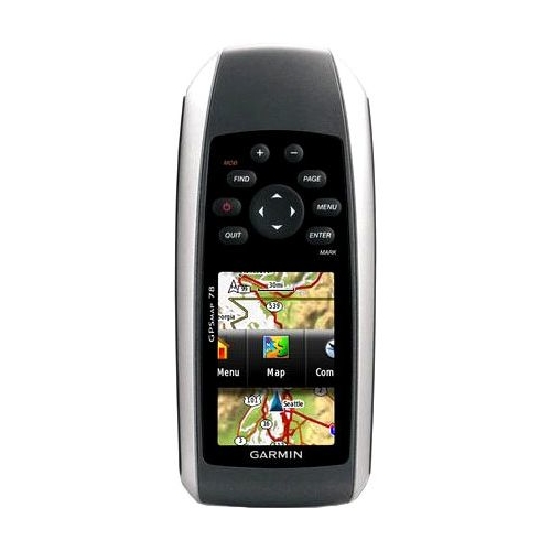
Very unusual in appearance tourist GPS-navigator. The fact is that its buttons are located above the display, and not under it. In this regard, management will have to get used to - it will take one or two forays into nature. Also, not all users will arrange a modest technical specifications. The composition of the gadget included only 1.7 GB of permanent memory. Do I need to say that such a volume does not contain the largest number of topographic maps? However, the problem is solved by using a microSD memory card. But with a low resolution LCD, there's nothing to be done. 160x240 pixels with a diagonal of 2.6 inches is not a progressive user.
Total device is able to keep in memory up to two hundred routes. This is quite an adequate figure. The capacity of the logbook is 10 thousand points, which is also unlikely to fail. As befits any GPS-navigator, he is able to independently calculate the route.
An internal antenna is built into the product. It perfectly recognizes signals from GPS satellites. The problem is the date of the announcement device. The fact is that this happened even before the mass popularization of GLONASS, so it’s not worth waiting for the support of Russian satellites. But with the protection of the gadget is all right. It can be dropped into the water - it is unlikely that something will happen to him. However, the case itself looks flimsy, so you don’t need to drop the device on the stones and asphalt - after that, scratches will definitely remain on it, and something less reparable can happen.
The work for the forest navigator that falls in our rating is provided by a set of two AA batteries. It should be enough for twenty hours of operation, when the screen backlight turns on only from time to time. Good result! It remains to remember to grab a few extra batteries on a multi-day hike.
Virtues
- There is a slot for microSD card;
- There is a sound alarm;
- Long battery life;
- The case is waterproof;
- Quick search for satellites;
- Work from an external power supply is possible.
disadvantages
- Strange button layout;
- Small amount of memory;
- There is no support for GLONASS;
- It is impossible to recharge the batteries right inside the device;
- Raster map support is poorly implemented.
Garmin eTrex 20x
Rating: 4.6
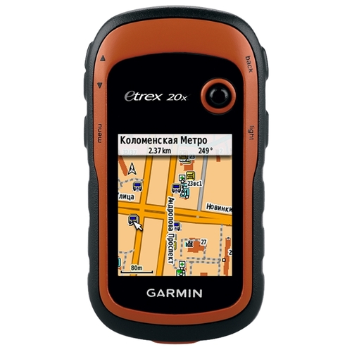
Closes our rating one of the cheapest navigators for the forest. No, there are even more inexpensive tourist GPS-navigators, but they look very simple, and their capabilities will not be enough for everyone. However, the functionality of Garmin eTrex 20x also can not be called very broad. Unlike more advanced models, this gadget is not able to independently find out the height above sea level at which the user is located. Also, there is no connector for an external antenna. I am glad that at least the slot for the memory card has not gone away. Still, the built-in memory here is a bit - about 3.7 GB, and in fact, topographic maps weigh a lot.
To control this device, quite tight buttons are used, located on the side ends. Also in this case helps the joystick, located near the screen. Unfortunately, in a backpack, if you have not blocked the keyboard, it is able to make spontaneous movements. It remains to be glad that most often it does not lead to anything particularly terrible - it’s just that the route is supplied with additional waypoints.
This navigator is able to store up to two hundred routes. There are no strong restrictions on the number of waypoints. The route is calculated fairly quickly, although it all depends on the distance you are going to cover. Not forgotten by the manufacturer and the function Track-Back, as there is here and an audible alarm.
The gadget got a pretty good display. With a 2.2-inch diagonal, it has a resolution of 240x320 pixels. Connoisseurs have already guessed that almost the same screen was used in the Nokia E65, Nokia N95 and other similar smartphones. As for the antenna, it is internal. It is because of this that you are unlikely to break the navigator. You can safely drop it into the water - it does not penetrate inside. Also, the navigator is not afraid of falling on a hard surface. Not only American but also Russian satellites are used as signal sources - this makes navigation much more accurate.
Like other low-cost travel guides from Garmin, the eTrex 20x is powered by two AA batteries or batteries. Unfortunately, the recharging of the latter inside the gadget is impossible. The battery life varies from 20 to 25 hours, depending on the regularity of activation of the display backlight and the type of batteries used.
Virtues
- There are additional applications;
- Very small size and weight;
- There is a slot for microSD card;
- A waterproof case is used;
- Long battery life;
- There are sound alarm and vibration;
- Not very high cost.
disadvantages
- Batteries will not be able to charge inside the device;
- No wireless modules;
- The display does not suit everyone.
Conclusion
This is the list of the best navigators for the forest. As you can see, these devices are very expensive. Unfortunately, now they are produced only by the company Garmin, and the monopolist of the market can assign any price tag. Also, low demand affects the cost - the product cannot be cheap if it is supplied in insufficient quantities.
Attention! This rating is subjective, is not advertising and does not serve as a guide to the purchase. Before buying, you should consult with a specialist.


